Are you a Guinness Book of World Records fan and a lover of the outdoors? If so, here are 7 places to visit that will satisfy both interests…and they’re all within Frederick County, the largest county by area in Maryland.
The Highest Cascading Waterfall in Maryland
Measuring in at 78 feet high, Cunningham Falls is on a short 1.25 mile loop trail in Cunningham Falls State Park. If you have a handicap placard, you can see the falls via a boardwalk from the ADA-only parking area located on Route 77.
The First Trout-Stocked & First Catch and Release Waterway in Maryland
Big Hunting Creek is a gorgeous creek that meanders down the eastern slope of Catoctin Mountain. The creek is Maryland’s first stream to be stocked with trout. It’s also the first Maryland stream designated as a fly-fishing-only stream. In the early 1960's it became the state's first Catch-and-Return Trout Fishing Area. Winston Churchill plus Presidents Roosevelt and Eisenhower all fished here. To enjoy the beauty of this creek or even fish in it, take Route 77 west off of Route 15. As you drive up Catoctin Mountain, the creek that parallels the road is Big Hunting Creek. There are multiple small pull-offs that you can use to park (make sure you’re totally pulled off the road), and then walk down to the creek.
The Highest Point in the County
Have you ever wondered where the highest point in the county is? If so, head to Catoctin Mountain to experience this unmarked spot first hand. The spot is 1910 feet above sea level! The location was where Foxville lookout tower stood. The former tower was 100 feet tall and was used to watch for fires. It collapsed in 1976 due to strong winds. To get to the highest point, take Route 15 north. Take the exit for 77 west. Drive up Catoctin Mountain. Pass Catoctin Hollow Road. Turn left on to Tower Road. Cross Fox Tower Road. Start driving slowly. On the right, you'll see an old swing gate with an old sign on it that says "No Parking in Driveway". (NOTE: If you pass the cell phone tower on the right, you've gone about 25 feet too far.). Park on the shoulder of the road, making sure to pull off the road as much as possible. Walk around the swing gate, and up the old grass-covered drive toward the small white "hut/shed". You’ll notice a small transmitter tower too (not to be confused with the cell phone tower that’s just a tad farther south on Tower Rd). Behind the little white hut, climb up the ridge. You are now on the highest point of the county! Congratulations! NOTE: Be extra cautious because timber rattlesnakes and copperhead snakes live on Catoctin Mountain.
The Lowest Point in the County
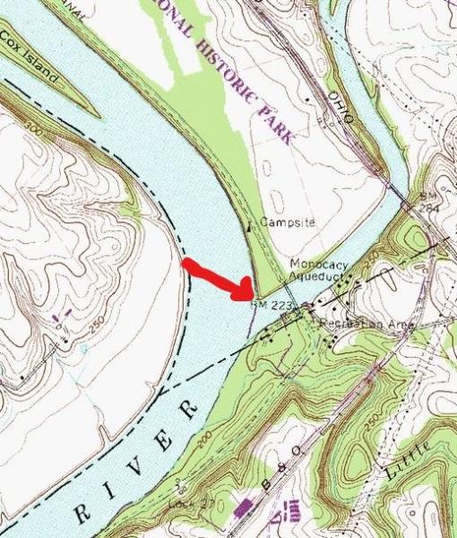
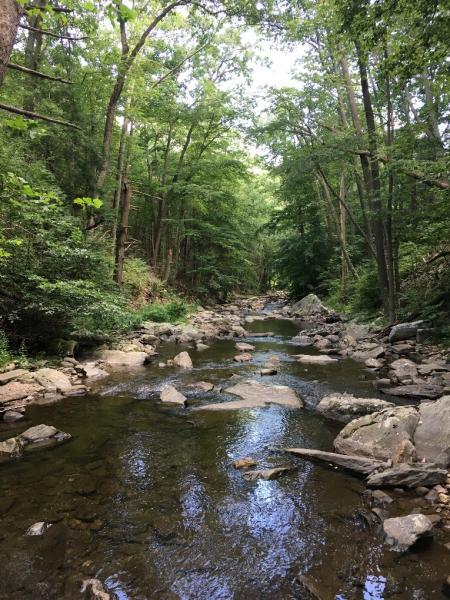
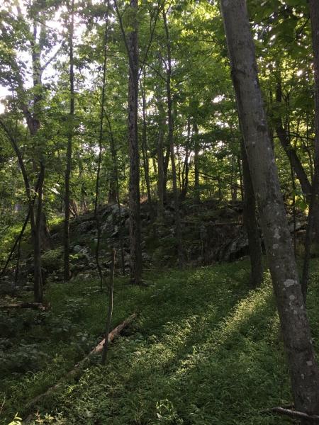
To experience the county’s lowest point, head to the Mouth of the Monocacy parking area on the C&O Canal. Once you park, walk across the historic Monocacy Aqueduct. Immediately after you’ve crossed the Aqueduct, you’ll see some giant stairs on your left. Go down those stairs and then follow the informal path that meanders through the forest toward the Potomac River. Once you get to the bank of the Potomac, carefully step down to the low point (see diagram below). Where the Monocacy flows into the Potomac River is our county’s lowest point where you’ll be standing 200 feet above sea level. NOTE: Only go to this location if water levels aren’t running high on the Potomac and Monocacy Rivers (i.e., it hasn’t rained recently).
The Longest County-Contained Hiking Trail
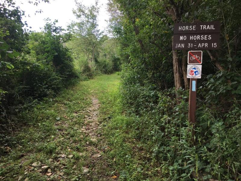
The Appalachian Trail or C&O Canal Towpath might be the first trail that comes to mind to fit this bill; but neither is entirely within the county’s borders (by a long shot). The Catoctin National Recreation Trail is totally within Frederick County and is the longest trail at 26.6 miles. Marked with blue blazes, it meanders along Catoctin Mountain through 4 areas: Catoctin Mountain Park, Cunningham Falls State Park, the Frederick Municipal Watershed (FMW), and Gambrill State Park. You can tackle this hike either in one fell swoop or as section hikes. The Potomac Appalachian Trail Club produces a detailed trail map of all 26.6 miles. The map is available at the Trail House (https://trailhouse.com/) in downtown Frederick.
The County’s Only Designated National Natural Landmark (NNL)
In 1969, Sugarloaf Mountain received this designation because of its being one of the "best" examples of a geological feature in its “bio-physiographic province”. According to the National Park Service’s NNL Program, "best" is based mainly on “illustrative value and condition of the resource”. Sugarloaf Mountain “provides evidence regarding age and structural relationships of rocks in the Piedmont bio-physiographic province. The site appears to be either an outlier to the east of the main mass of the Catoctin Mountain, or a root remnant of the ancient Appalachia land mass.” So, whether you want to visit the mountain for this designation, or so that you can say that you hiked trails on a monadnock which is “an isolated hill or small mountain rising abruptly from gently sloping or level surrounding land”, Sugarloaf Mountain is a great place to check out.
Possibly the Longest Planted Water Garden in the World

Though the initial purpose of creating this garden was to limit algae growth on Carroll Creek as it flows through Historic Downtown Frederick, the end result of Color on the Creek’s (a non-profit organization) annual planting of tropical water plants in the creek is a stunning ¼ mile long water garden. It also might possibly be the longest planted water garden in the world. Stroll along Carroll Creek Linear Park during the summer months to enjoy 4000 water plants as their blooms beckon to you.